| Santorini Itineraries | Itinerary Fira-Oia | Itinerary Fira-Akrotiri | Itinerary Fira-Pyrgos | Itinerary Caldera | Tours on the island | ||||||||||||||||||||||||||
| Santorini Sailing Cruises | Santorini Volcano Tour | Cruise Ship Tours | ||||||||||||||||||||||||||
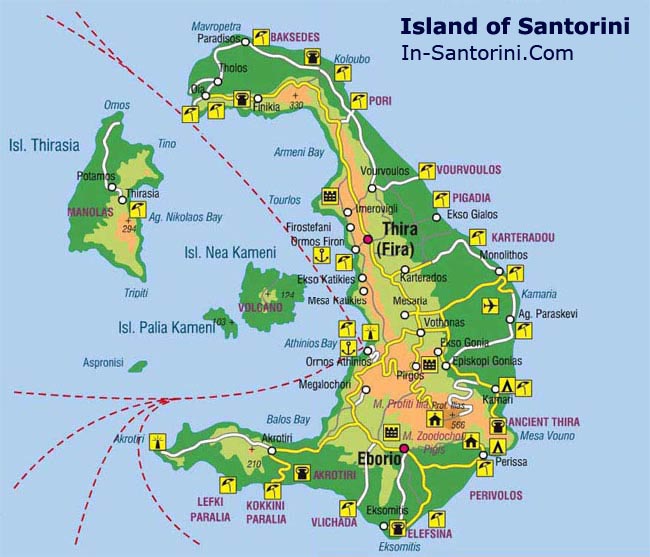
√ Excursions in Santorini: Fira'-Oia (16 km) |
||||||||||||||||||||||||||
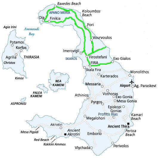 |
The most interesting thing of this itinerary is that it includes all villages located on the top of the slope and overlooking the Caldera: Firostefani, Imerovigli, Oia. Firostefani: from the main square in Firà take the road towards the north. After approximately 800 m you arrive in the square of Firostefani, extension of Firà. It's a village that rises along the edge of the slope, with restaurants, hotels and a charming church, Saint Gerasimus, framed by tall cypress trees, which is rather rare in the island. Imerovigli-Skaros: after the Monastery of Saint Nicolas, only 2 km from Firà, you get to Imerovigli, located in the middle of the island on its highest point. Its privileged location lets you enjoy one of the most spectacular and unforgettable views the Caldera. |
Crossing the village towards the Caldera, there is a path that leads to Skaros (in the past one of the five most important centres of the island - today there are only few traces of it). One of the most beautiful walks (about 1 hour goign up to Skaros) is to follow the path that leads to the Church of "Theoskepastì", a white church, built on the top of the rock. It is the most impressive location of the island! Oia: Is the main village in the northern side of the island, just 11 km from Firà. Its architecture is unique, with 2-storey coloured houses, carved into the lava rock. Walls are painted in ochre, window frames and doors are in red travertine. Streets in the town centre, unlike the rest of the island, are paved in marble. Two downward streets lead to the bay of Armeni and to the beach of Ammoudi. The first one offers water skiing activities, taverns to eat the catch of the day (or, better, of the minute) ... the second one offers romantic walks and a boat to reach Thirasia. Back to Firà: The east coast road back to Firà crosses Baxedes, a small village with both a sandy and rocky beach, not crowded at all. After 17 km you will arrive to the hill top village of Koloumbos, with a sandy beach at its base and a submarine volcano on the east side. |
|
about us | site map | advertising | contacts | disclaimer | links |